Nincs termék a kosárban!
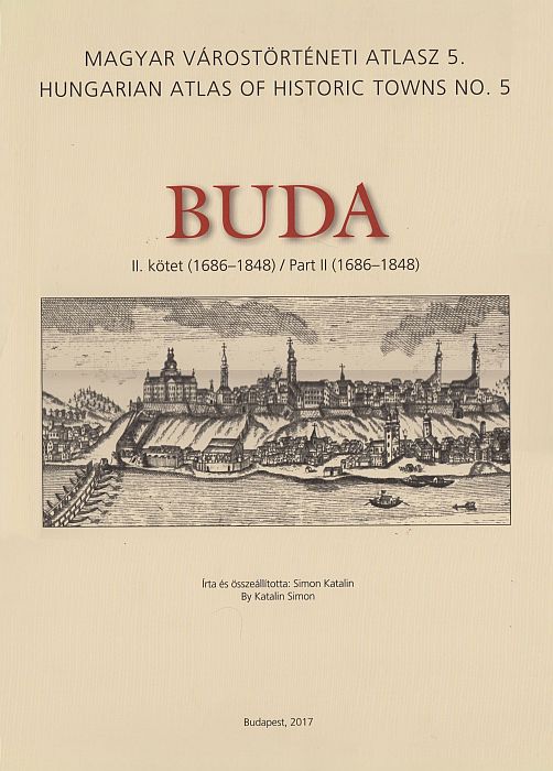
Simon Katalin: Buda II. kötet (1686-1848) - Magyar Várostörténeti Atlasz 5. / Hungarian Atlas of Historic Towns No. 5.
Cikkszám : 9786155635076
Kiadó:
Budapest Fõváros Levéltára
Fogyasztói ár7.500 Ft
Ár / COM_VIRTUEMART_UNIT_SYMBOL_darab:
A szerző Budapest Főváros Levéltára gazdag anyagát, a levéltári forrásfeltárás, adatbázis-építés és digitalizáció eredményeit hasznosítva kalauzolja el az olvasót Buda 1686–1848 közötti történelmébe. Az adatgazdagság és dokumentáltság emeli ki a kötetet a városatlaszok sorozatából, olyan tudásanyagot tesz közzé a főváros 1848-ig terjedő története kapcsán, amelyet eddig, így összegezve, adatárral, térképi illusztrálással nem volt módunk megismerni.
Tartalom
Kísérőfüzet
Buda történeti helyrajza Történeti topográfiai adattár Bibliográfia
Térképtáblák A. Általános térképek
A.1 Az 1873-as kataszteri felmérés (BFL XV.16.a.201/9) alapján szerkesztett térkép, 1:2 500
A.2.1 Részlet az I. katonai felmérésből, 1782-1785
A.2.2 Buda külterülete, 1785 körül
A.2.3 Buda áttekintő térképe, 18. század vége
A.2.4 Buda és környéke, 1836
A.3.1 Buda a 17-18. század fordulóján
A.3.2 Buda a reformkorban
A.4 Buda topográfiai térképe, 2005, 1:10 000
A.5 Buda központja légi felvételen, 2005
B. Tematikus térképek
B.1 Középületek Budán a 18. század végén
B.2.1a A Tabán és a Víziváros központja 1818-ban az 1818-1819. évi nem nemesi összeírás alapján
B.2.1b Házhelyek háztömbönként 1818-ban a Tabán és a Víziváros központjában az 1818-1819. évi nem nemesi összeírás alapján B.2.1c Családok száma háztömbönként 1818-ban a Tabán és a Víziváros központjában az 1818-1819. évi nem nemesi összeírás alapján B.2.1d Lakók száma háztömbönként 1818-ban a Tabán és a Víziváros központjában az 1818-1819. évi nem nemesi összeírás alapján B.2.1e Felekezeti megoszlás családonként 1818-ban a Tabán és a Víziváros központjában az 1818-1819. évi nem nemesi összeírás alapján
B.2.2 Az egyes foglalkozási ágak családfők szerinti megoszlása háztömbönként 1818-ban a Tabán és a Víziváros központjában az 1818-1819. évi nem nemesi összeírás alapján
C. Térképek és látképek reprodukciói
C.1.1 Joseph Hauy: Plán de la vilié et chateav de Bvde, 1687
C.1.2 Nicolas Marcel de La Vigne: Budae ac Pesti ichonographica descriptio, 1686, secunda tabula
C.1.3 A Vár és közvetlen környezetének erődítési térképe, 1749
C.1.4 A Víziváros áttekintő térképe, 1786-1792
C.1.5 A budai Vár helyszínrajza, 1786-1794
C.1.6 Újlak és Országút áttekintő térképe, 1802
C.1.7 A halászvárosi támfal terve, 1812
C.1.8 A Vár, Rácváros, Krisztinaváros és Víziváros részletes térképe, 1824
C.1.9 Pest, Buda, Óbuda vízrajzi térképe, 1833
C.1.10 Buda látképe nevezetességeinek képeivel, 1837 körül (Carl P. Vasquez)
C.2.1 Frans Geffels: Buda ostroma, 1686
C.2.2 Alexander Glásser (Friedrich Bernhard Werner rajza alapján): Buda látképe, 1732
C.2.3 Josef és Peter Schaffer: Buda és Pest látképe, 1787
C.2.4 Petrich András: Buda és Pest ünnepi kivilágítása, 1814. október 24.
C.2.5 Richter Antal Fülöp (Petrich András nyomán): Buda és Pest a Gellérthegyről, 1818
C.2.6 Jacob Hyrtl: Buda és Pest látképe, 1832
C.2.7 Franz Xavér Sandmann: Buda és Pest látképe a Gellérthegyről, 1848
G.3.1 Andreas és Josef Schmutzer (Mikoviny Sámuel alapján): Buda látképe, 1737
C.3.2 Johann Christian Leopold (Friedrich Bernhard Werner alapján): Buda és Pest látképe keletről
Table of Contents
Accompanying booklet The Historical Topography of Buda Historical-topographical Gazetteer Bibliography
Plates (maps and views)
A General maps
A. 1 Base map drawn after the cadastral map of 1873, 1:2 500
A.2.1 Detail of the First Military Survey, 1782-1785
A.2.2 The surroundings of Buda around 1785
A.2.3 Overview map of Buda, laté 18th century
A.2.4 Buda and its surroundings, 1836
A.3.1 Buda at the turn of the 17th and 18th centuries
A.3.2 Buda in the Reform Éra (c! 1830)
A.4 Topographical map of Buda, 2005, 1:10 000
A.5 Aerial photograph of the centre of Buda, 2005
B Plates of thematic maps
B. 1 Public facilities in Buda in the end of the 18th century
B.2.1a The centres of Tabán and Víziváros in 1818 based on the 1818-1819 census of the non-noble population B.2.1b House plots by blocks in the centres of Tabán and Víziváros in 1818 based on the 1818-1819 census ofthe non-noble population B.2.1c The number of families by blocks in the centres of Tabán and Víziváros in 1818 based on the 1818-1819 census of the non-noble population B.2.1d The number of inhabitants by blocks in the centres of Tabán and Víziváros in 1818 based on the 1818-1819 census of the non-noble population B.2.1e Religious denominations by families in the centres of Tabán and Víziváros in 1818 based on the 1818-1819 census ofthe non-noble population
B.2.2 The distribution of the individual occupations by the heads of families in the centres of Tabán and Víziváros in 1818 based on the 1818-1819 census of the non-noble population
C Reproductions of maps and views
C. 1.1 Joseph Hauy: Plán de la vilié et chateav de Bvde, 1687
C. 1.2 Nicolas Marcel de La Vigne: Budae ac Pesti ichonographica descriptio, 1686, secunda tabula
C. 1.3 Map of fortifications in the Castle District and its surroundings, 1749
C. 1.4 Overview map of Víziváros, 1786-1792
C. 1.5 Site map of the Castle, 1786-1794
C. 1.6 Overview map of Újlak and Országút, 1802
C. 1.7 Plán of the buttress in Halászváros, 1812
C. 1.8 Detailed map ofthe Castle, Rácváros, Krisztinaváros and Víziváros, 1824
C.1.9 Hydrographical map of Pest, Buda and Óbuda, 1833
C.1.10 Map and view of Buda with the pictures of its sights, around 1837 (Carl P. Vasquez)
C.2.1 Frans Geffels: The siege of Buda, 1686
C.2.2 Alexander Glásser (after the drawing of Friedrich Bernhard Werner): View of Buda, 1732
C.2.3 Josef and Peter Schaffer: View of Buda and Pest, 1787
C.2.4 András Petrich: Floodlight of Buda and Pest, 24 October 1814
C.2.5 Antal Fülöp Richter (after András Petrich): Buda and Pest viewed from Gellért Hill, 1818
C.2.6 Jacob Hyrtl: View of Buda and Pest, 1832
C.2.7 Franz Xavér Sandmann: Buda and Pest viewed from Gellért Hill, 1848
C.3.1 Andreas and Josef Schmutzer (after Sámuel Mikoviny): View of Buda, 1737
C.3.2 Johann Christian Leopold (after Friedrich Bernhard Werner): Buda and Pest, viewed from the east
Kiadási év: 2017
Ajánljuk még: